Van Wagner's Beach history

Bernie

Registered User
Jul 21, 2012
2
0
0
#1
What I'm looking for are photos, articles, maps, contacts for other people, or anything that might help me with the history of these two sites. The first one was a small cottage we rented (when I was aged 2 to 4) from the owner of the land that now holds the naval memorial stones to the sailors of the Hamilton and Scourge. The owner's house was situated right where those rows of stones are now. Our cottage, and three others, were a few hundred feet away closer to the turtle pond that has the pedestrian bridge going over it. There were also at least two large greenhouses and other smaller sheds. My parents always referred to it as 'Howard's" and I believe the owner ran the business as "John Howard Florist". All the rest of the property was covered with rows and rows of all kinds of flowers all the way to the highway. Back then, the large traffic circle butted up against the property. When I was four years old, the City was in the process of buying out the owner to make way for Confederation Park to eventually take over the land and as such, we had to move.


The City then offered to rent us our next house, just down the road at 190 Nash Rd North, right across from the old Hutch's Dingley Dell. I lived there from four to eight years old and have many great memories of the beach, Hutch's, the orchards across from our house and the forest and fields around us. The house now, with a new address of 585 Van Wagner's Beach Rd, is used as the offices and yard/maintenance area for the park people. My aunt, uncle and cousins rented the house next to us, right next to the stream. It was a treat, after 50 years, to be able to go inside the office and have a tour through the old house again. Even with some of the changes made over the years, it was still very much 'home'.


I was hoping, that by joining your HBC site, I might find others who lived in the area or know some of the background to these properties. I realize that most of your members, from what I have read, are more a part of the beach community running from the stop lights at Van Wagner's Beach Rd all the way to the bridge and beyond, but I have my fingers crossed that some of those will also have family history or knowledge going in the other direction.


This then is a brief background of my reasons for joining and hope I can fit in at the site.
 

Sharla1

Registered User
Oct 15, 2009
1,262
17
38
68
#2
Welcome to the forum Bernie. Hopefully some of the others here can eventually help you with this info.
 

Drogo

Moderator
Feb 8, 2005
402
2
18
#3
Welcome Bernie
I'm working on the same area. I can tell you something about the mid to late 1800s but when you are looking my knowledge on Peter Van Wagners property is very limited. My family lived on the Beach side of the creek that runs parallel to the lake. The Hamilton and Scourge Memorial is directly in front of where their house was. You were referring to the timeframe when the City was purchasing land for the Park. One of the old family was still living there until just before that time. Mortimer Corey. He was a fisherman and owned the Edgewater Hotel at one point. His children were paid for his property for the Park.
 

scotto

Administrator
Staff member
Feb 15, 2004
6,985
218
63
The Beach Strip
#4
Hi Bernie

Thanks again for joining, as I have already discussed with you, we don't have a lot of history concerning Van Wagner's Beach, however we do have a thread in the Photo Gallery section of the Forum. I believed you have already read through there, but here is a link for the others that may be reading this post.
http://hamiltonbeachcommunity.com/forum/threads/van-wagners.1944/

A Spec article here;
http://hamiltonbeachcommunity.com/forum/threads/school-closed-in-1961-but-still-students-come.1242/

And the school yearbook, The Gem;
http://hamiltonbeachcommunity.com/forum/threads/van-wagners-beach-school-yearbook.1388/

Also, the annual Beach Reunion is scheduled for the end of September and a few of the Van Wagner's crowd do attend.
 
Last edited:

Bernie

Registered User
Jul 21, 2012
2
0
0
#5
Thanks, all, for your kind words and comments. The more I dig into the history of this area, the more interesting it gets. I never knew all these families and farms lived in the area before I lived there. Most traces of them had disappeared by that time. I lived in the cottage at Howard’s property from 1959 to about 1960-61. Then we moved over to Nash Rd and lived there until 1966 when we moved up on the Mountain. I always remember my mom telling me that the City moved all four of those cottages up to the Indian Reservation for housing. I don't know what year our house on Nash Rd was built, or who owned it prior. I do remember playing on the overgrown concrete floor of a garage or shed across the street from us, but don't know if a house was there. There was also one of these old concrete floors behind our house a bit that I used to ride my tricycle on. (yes, 3 wheels, I hadn't graduated to 2 wheels at that point!)

I would love to have a large air photo of the Van Wagner’s Beach area, such as those kept in the Lloyd Reeds Map Collection at McMaster, and label all the different houses, farms, businesses, etc. with the names of all the owners during each time period.

If I were more knowledgeable technology-wise, I could figure out how to do this. But for now, I’ll just have to keep asking around if people have old family photos of the area that I can copy.
 

David O'Reilly

Registered User
Dec 15, 2012
481
4
18
#6
Drogo,
I've found some history for the period that you are interested in.

1867 - In December, the schooner ALBERT of Detroit, was driven ashore at Van Wagner's Beach. At daybreak the following morning, a local farmer sighted the ice-covered wreck with seas crashing over her. Mounting his horse, he spread the alarm and Col. Van Wagner took charge of the rescue operation which was accomplished by two men pushing a small boat along planks, laid on the heaving shore ice, until it floated. Each time that two of the schooner's crew got into the boat, it was pulled back to shore by the farmers and fishermen gathered there. In this way, all hands were saved.
http://www.maritimehistoryofthegreatlakes.ca/documents/Brookes/default.asp?ID=Y1867#p11.67.27

is 'Col. Van Wagner' who the beach is named after?
 

David O'Reilly

Registered User
Dec 15, 2012
481
4
18
#11
Bernie,
"What I'm looking for are photos, articles, maps, contacts for other people, or anything that might help me with the history of these two sites. The first one was a small cottage we rented (when I was aged 2 to 4) from the owner of the land that now holds the naval memorial stones to the sailors of the Hamilton and Scourge. The owner's house was situated right where those rows of stones are now."

Bernie, have you tried finding the names of former land owners at the land registry office? The question is, 'which land registry office, 'Hamilton' or 'Salt Fleet Township'. It depends on exactly when you are talking about.
 

scotto

Administrator
Staff member
Feb 15, 2004
6,985
218
63
The Beach Strip
#12
Bernie,
“What I'm looking for are photos, articles, maps, contacts for other people, or anything that might help me with the history of these two sites. The first one was a small cottage we rented (when I was aged 2 to 4) from the owner of the land that now holds the naval memorial stones to the sailors of the Hamilton and Scourge. The owner's house was situated right where those rows of stones are now.”

Bernie, have you tried finding the names of former land owners at the land registry office? The question is, ‘which land registry office, ‘Hamilton’ or ‘Salt Fleet Township’. It depends on exactly when you are talking about.
I would look at Saltfleet as the place to look, Drogo (Peggy) runs a Saltfleet Site and I believe they (Peggy and Bernie) have consulted on the topic.
 

Drogo

Moderator
Feb 8, 2005
402
2
18
#14
Bernie,
“What I'm looking for are photos, articles, maps, contacts for other people, or anything that might help me with the history of these two sites. The first one was a small cottage we rented (when I was aged 2 to 4) from the owner of the land that now holds the naval memorial stones to the sailors of the Hamilton and Scourge. The owner's house was situated right where those rows of stones are now.”

Bernie, have you tried finding the names of former land owners at the land registry office? The question is, ‘which land registry office, ‘Hamilton’ or ‘Salt Fleet Township’. It depends on exactly when you are talking about.
The registration would be through Saltfleet. On the map, that is on this site, that is huge and shows the people from one end of the beach to the other you will see a small lot on the beach east of the little creek says "N Corey". That was my family. I went to that spot last year and the memorial is directly behind this property. The owner on that map was P. Van Wagoner. I assume is Peter Van Wagoner. I'm sure the property changed hands a few times but it gives you the orginial owner to identify the lot of land.
 

scotto

Administrator
Staff member
Feb 15, 2004
6,985
218
63
The Beach Strip
#15
The Globe and Mail, Jan. 23rd, 1875.
One day last week Mortimer Corey, fisherman, Burlington Beach, while getting a pale of water from the lake, slipped off the high ice banks into the water. The waves were rolling from a north north-east storm, and the poor man was borne about by the breakers for half an hour, until he was almost exhausted and chilled to death, and had it not been for his little daughter hearing his cries and bringing someone to the rescue, would have perished, as it was impossible for him to climb over the ice breaks unassisted.
 

scotto

Administrator
Staff member
Feb 15, 2004
6,985
218
63
The Beach Strip
#18
It was part of Hwy 20 though. And that included Beach Blvd. My guess is that it was decommissioned in the late 60s, though some early 70s maps still show Van Wagners/Beach Blvd as Hwy 20.
I don't have a date for this map, I am guessing mid 1950's, Hwy 20 is clearly marked on Van Wagner's and Beach Blvd.

Streets3.jpg
 

scotto

Administrator
Staff member
Feb 15, 2004
6,985
218
63
The Beach Strip
#20
Van Wagner's Golf Course

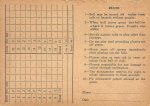
Peggy has found something interesting, apparently there was an 18 hole, par 46 golf course located somewhere on Van Wagner's Beach. She found a score card for the club and the title on the front is Wilson's Van Wagner's Beach Golf Course, but I have no idea where it was located.
 

Attachments

Top Bottom